The Greatest Divide
Colorado’s Loveland Pass is a superb (if slightly harrowing) Rocky Mountain high.
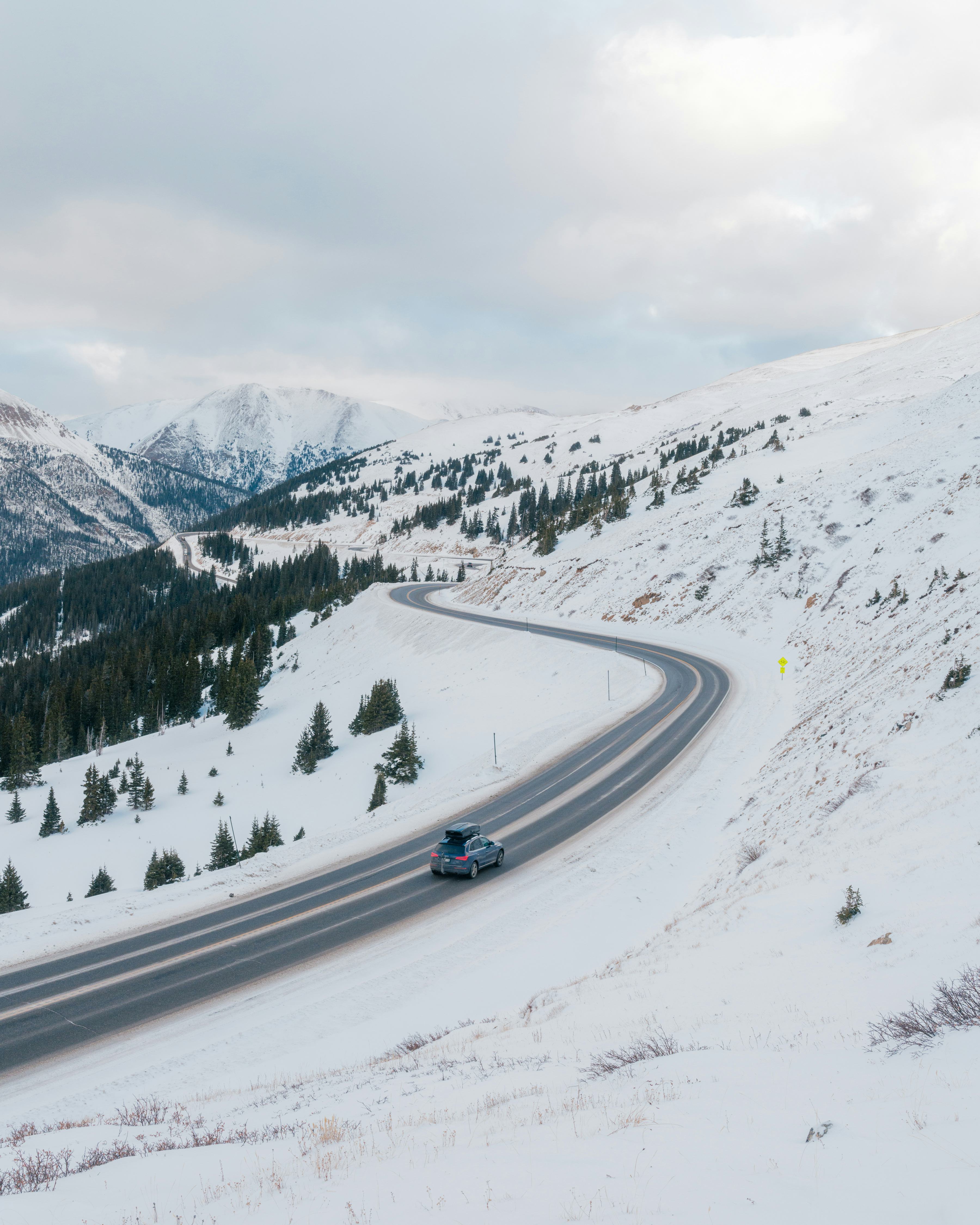
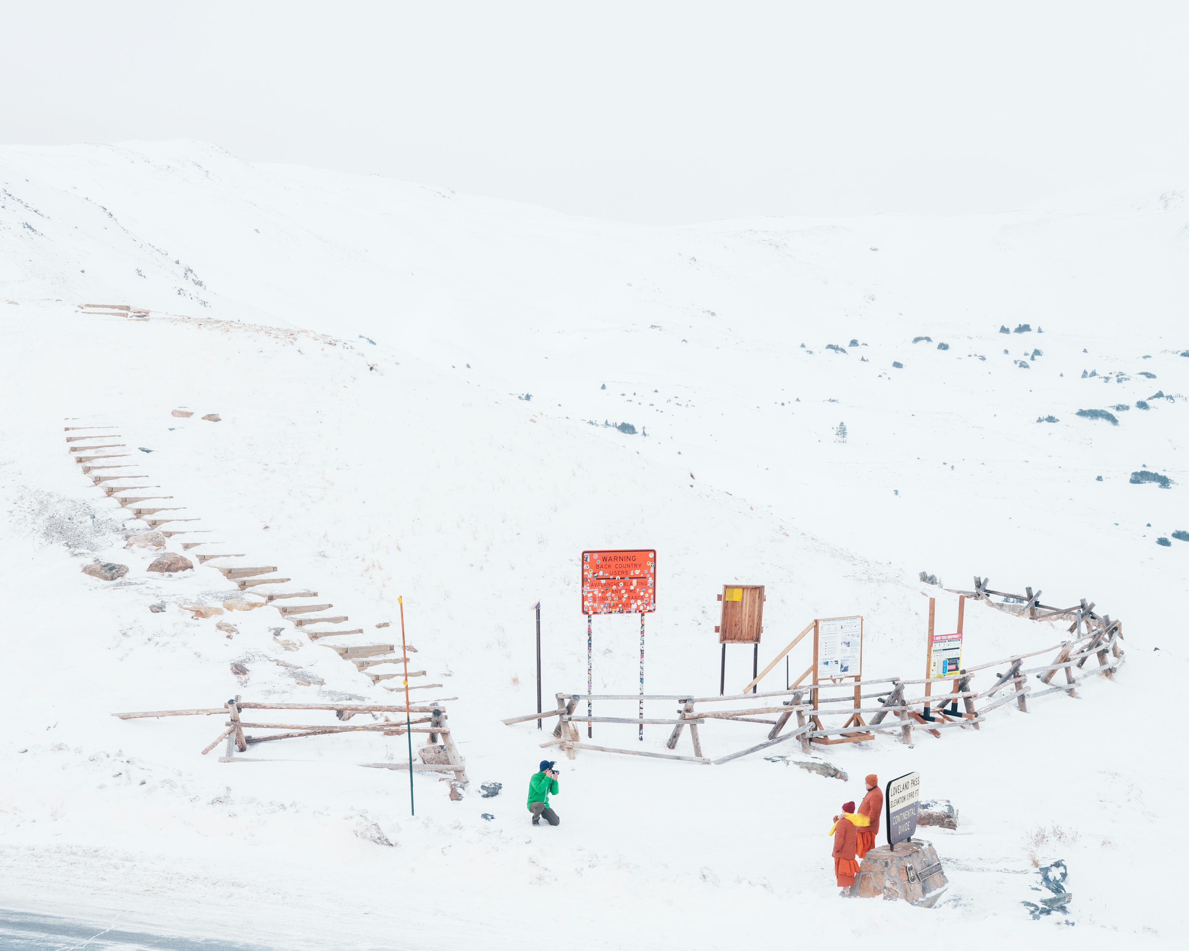
BEFORE THE EISENHOWER TUNNEL brought four lanes of Interstate 70 through the granite heart of the Colorado Rockies, there was Loveland Pass, a sky-grazing detour over the Continental Divide. When it opened as a wagon road in 1879, the route was a marvel: a dirt ribbon descending into a wondrous cup of a valley, surrounded by snowmelt streams, bighorn sheep on craggy ridges, and tumbling forests of spruce, fir and pine. A car first crested it in 1929, though it wasn’t paved until 1950. Today, it’s a 20-mile stretch of U.S. 6, straddling the Divide at a dizzying 11,990 feet.
One of Colorado’s highest passes, Loveland is also one of the few open year round. This time of year, reaching it from the Front Range means joining throngs of I-70 pilgrims making for ski country. West of Silver Plume—rich with buildings circa the 19th-century gold and silver rushes—U.S. 6 leaves the Clear Creek Valley near Loveland Ski Area, climbing steeply to the pass. The road is narrow as hell, without a guardrail in sight: intense driving in any season, but especially winter. A set of chains is your friend, as are state DOT travel alerts (get the invaluable COtrip app)—you don’t want to get stuck here in a whiteout. But with risks come rewards: overlook views are vast, the beauty of the surrounding peaks almost bewildering.
Don't Miss
➀
On Silver Plume's Main Street, PLUME COFFEE BAR slings good espresso and breakfast burritos in an 1870s false-front.
➁
Arapahoe Basin's lift-accessed, solar-powered IL RIFUGIO is the continent's highest restaurant, serving charcuterie and IPAs at 12,456 feet.
➂
Skating's free at the KEYSTONE LAKE RINK, the rare Zamboni-groomed outdoor ice with a view.
➃
The 1918 RICE BARN is a gambrel-roofed remnant of the stagecoach era, smack in the middle of a condo development.
In summer, ridgeline trails snake off towards neighboring Mount Sniktau and fourteeners Grays and Torreys peaks, and picnickers lounge at Pass Lake, just below the high point. The rest of the year, most drivers are headed to Arapahoe Basin and Keystone ski areas. Founded by a 10th Mountain Division vet before the road was paved, A-Basin leans into its rep as a low-frills “anti-resort” full of gnarly expert terrain. Beginner-friendly Keystone, meanwhile, is surrounded by condo-village sprawl and surprising little pockets of mining, logging and homesteading history. At either spot, the lot scene is a carnival of kids suiting up, dogs burning energy and skiers cracking après beers.
Rejoining the interstate in Silverthorne, you’re not 10 miles from where the tunnel would have spit you out. Without stops, the bypass might add an hour. But on a bluebird day, the sun glinting off the slopes, it feels removed from time entirely.
